All Categories
All Categories


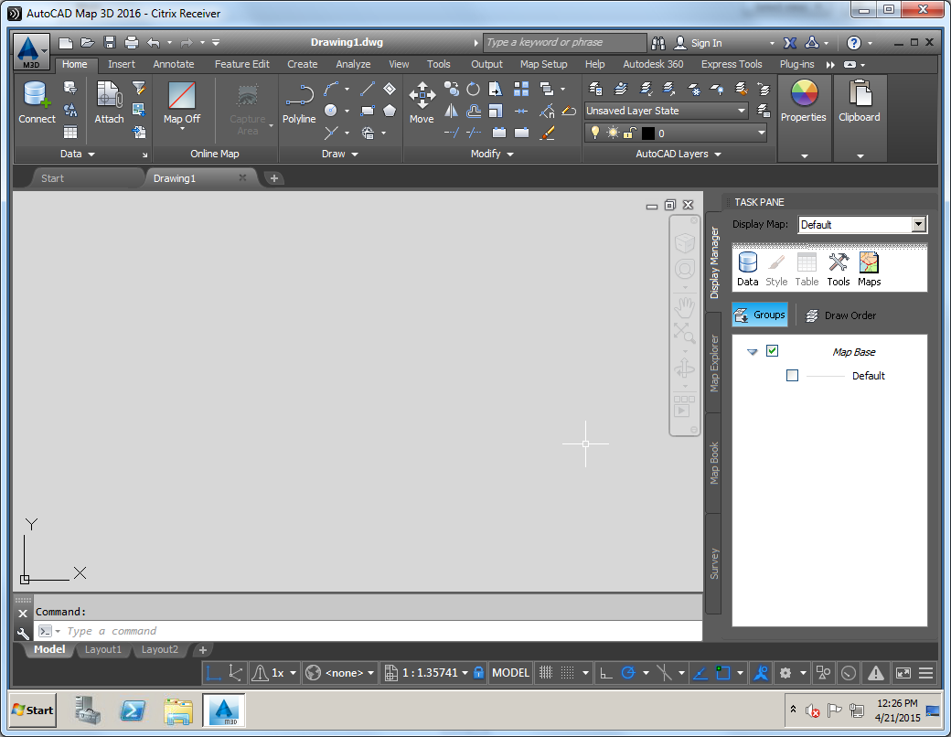
Model-based GIS and mapping software - Use AutoCAD® Map 3D software to get broad access to CAD and GIS data to support planning, design, and data management.
Compatibility
-
 Citrix Virtual Apps
6.5
Citrix Virtual Apps
6.5
Product Details
Model-based GIS and mapping software
Use AutoCAD® Map 3D software to get broad access to CAD and GIS data to support planning, design, and data management.
Access CAD and GIS data to apply to 3D models
With AutoCAD® Map 3D software, you can access and use CAD and GIS data from a range of sources. View images and video to see how comprehensive gas, water, wastewater, and electric industry data models can help you more easily organize disparate asset information and apply industry standards and business requirements.
Features
Analysis tools
Answer questions and make data decisions. GIS analysis and planning tools
Coordinate systems and geolocation
Bring aerial information into your maps.
Create coordinate systems (enhanced)
Choose a coordinate system or create your own.
Create and edit symbols
Import and customize public-domain symbols.
Dynamic tooltips and links
In-product tips and links aid productivity.
Data management tools (enhanced)
Model data is portable and customizable.
Access industry models in more formats (enhanced)
FDO enhancements enable SQL access.
Workflows and feature rules
Customize feature rules for specific tasks.
Convert data to intelligent industry models (enhanced)
Convert GIS and CAD data.
Configure linear referencing systems
Create an LRS model.
Industry model analysis
Identify connected facilities and analyze impact
Take industry model data offline
Make changes locally; sync to desktop applications.
Desktop to web to A360
Easily share GIS maps online with A360.
Publish directly to the web
Publish native DWG.
Interoperate with AutoCAD and GIS software
Choose from a variety of widely used GIS formats.
Data access and management
FDO provider for ArcGIS.
Dynamic legends, north arrows, and scale bars
Insert scale bars and other viewports.
Grids, graticules, and map books
Choose how you want to present your maps.
Topographical data directly from the source (enhanced)
Access topographical data directly from the source.
Data access and management
FDO provider for ArcGIS.
Survey functionality
Survey tools use data from a variety of sources.
Surfaces and point cloud tools (enhanced)
Use points and contour data to create models.
Screenshots